|
Landsat Landcover 1988-1990
|
|
|
Georgia
|
|
|
1:100,000
|
|
|
ESRI Export File (.e00)
|
|
|
Lambert Conic Conformal
|
|
|
Georgia Department of Natural Resources
|
|
|
|
|
|
1995
|
|
|
|
|
|
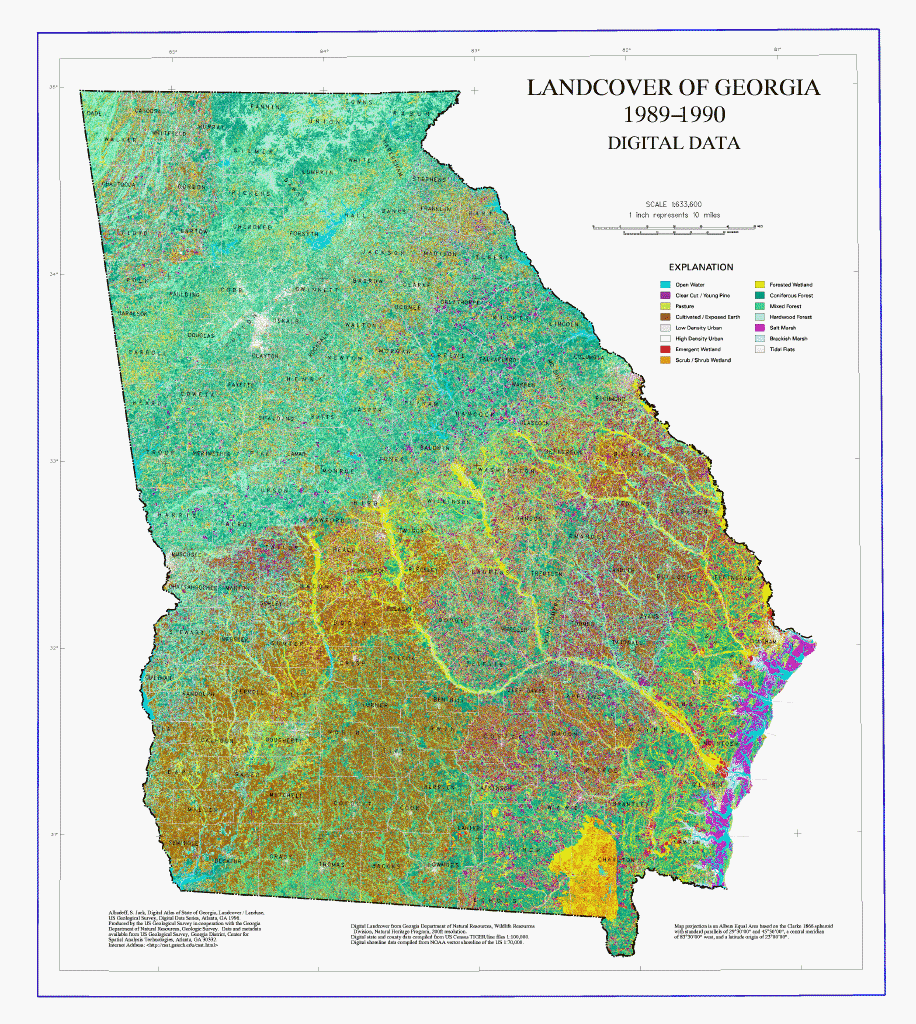
This Landcover map file is based on LANDSAT Thematic Mapper satellite imagery with a spatial resolution of 100 ft. x 100 ft. Image dates are winter 1998-1990. Landcover classification was performed by ERDAS, Inc. and the Wildlife Resources Division of Georgia's Department of Natural Resources (GaDNR). LANDSAT
Thematic Mapper bands 1 through 5 were used in the classification. The landcover classification was derived from a limited number of field samples; the classification process grouped areas with similar spectral characteristics as observed by LANDSAT sensors. Limited ground-truthing was performed on the landcover map files. Class determinations met a minimum accuracy level of 85%. In 1995 this database was partially revised by the GaDNR, Natural Heritage Program to reflect alterations to the agricultural landcover information primarily in Southwest Georgia. The data were also resampled to 200 ft. at this time in order to reduce file size.
|
|
|
This database was originally developed to support the State Planning Act of 1989. It is useful for regional and local environmental investigation and planning. This map file does not represent an attempt to define jurisdictional limits of any federal, state, or local government with respect to wetlands or any other landcover type. The Georgia Department of Natural Resources, the Georgia Department of Community Affairs, and ERDAS, Inc. assume no liability in the use of this or related data.
|
|
|
For more information about this dataset please visit the
Georgia Department of Natural Resources.
|
|
|
Preview Image
|
|